
Tabel Of Contents
- Trekking Region Affected by Flash Flood in Nepal
- Which Nepal Treks Are Open Right Now: Region-by-Region Status
- What Caused the 2026 Nepal Flash Flood?
- Langtang, Gosaikunda and the Tamang Heritage Trail: The Honest Picture
- If You Are a Woman Trekking Alone, or Already in Nepal
- Alternatives to a Langtang Trek This Autumn
- Should You Cancel, Postpone, or Go?
- Conclusion: Nepal Needs Responsible Travelers Now More Than Ever
- Frequently Asked Questions
Yes, trekking is still possible in many parts of Nepal after the devastating Rasuwa flash flood on August 26, 2026, but whether it is safe to trek depends on the region, route, and current access conditions. Nepal remains open to international travelers, with specific areas affected by the disaster still experiencing disruptions to roads, bridges, trails, and infrastructures.
The biggest impact will be for trekkers in Rasuwa and the Langtang area. Roads and bridges to Langtang from Dhunche and Syabrubesi were severely damaged, and the region remains inaccessible. Nepal Tourism Board updates too have advised trekkers to refrain from taking the usual Dhunche route to Gosaikunda as authorities assess the situation and alternative access routes.
But this does not imply that all of Nepal’s trekking regions are closed or unsafe. It’s very much a regional impact. Trekking zones such as Everest, Annapurna, Manaslu, etc. should be evaluated individually and should not be treated as one impacted destination.
This guide offers women trekkers a region-by-region up-to-date status report on Nepal’s major trekking zones and explains which routes are affected and what you should do if you already have a trekking booking.
If you are planning a trek in Nepal or already have a booking, use this guide in conjunction with the latest advice from your trekking operator and local authorities. Also, it is to note that conditions in the affected corridor are still changing from week to week as search, rescue, road clearance, and infrastructure assessments continue.
Trekking Region Affected by Flash Flood in Nepal
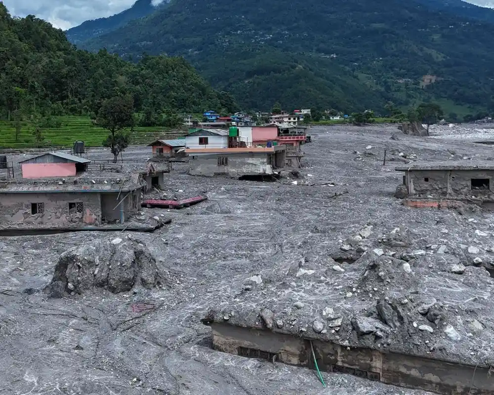
Of Nepal's major trekking regions, only Langtang, which includes Gosaikunda and the Tamang Heritage Trail, sits on the river system that flooded. Everest, Annapurna, Manaslu, Mardi Himal, Kanchenjunga, and Makalu were never physically in the flood's path.
The 2026 Nepal flash flood travelled down a single drainage: it began in the Lhende Khola near the Nepal–Tibet border, entered the Bhote Koshi, and continued into the Trishuli and the Narayani further downstream. Every settlement destroyed on 26 August sits along that one corridor, which lies in the Langtang region.
Nepal's other trekking regions drain into completely separate river systems. The Everest region feeds the Dudh Koshi. Manaslu sits on the Budhi Gandaki. Annapurna drains into the Marsyangdi and the Kali Gandaki. Kanchenjunga and Makalu, far to the east, belong to the Tamor and Arun networks. None of these connect to the Bhote Koshi, which is why trails, teahouses, and airstrips in those regions were physically untouched by the flood.
One caution before you read the region table as an all-clear. "Outside the flood's path" is a statement about geography, not a seasonal safety guarantee. Nepal's monsoon runs into mid-September, and landslides, washed-out feeder roads, and delayed mountain flights are ordinary risks across the country this month, flood or no flood. Several of the most significant road closures right now are monsoon-related rather than flood-related, and they affect regions the flood never reached.
Which Nepal Treks Are Open Right Now: Region-by-Region Status
Status values below mean exactly three things: Operating normally: trails and access functioning as usual. Access disrupted—confirm before booking: the destination is not damaged, but getting there is unreliable. Not currently accessible to trekkers: official advisories say do not go.
| Trekking region | Status (2 Sept 2026) | Access route | What to confirm before you go |
| Everest / Khumbu | Operating normally | Flights to Lukla from Kathmandu or Ramechhap | Lukla flight reliability in late monsoon |
| Annapurna | Operating normally on the trails; road access disrupted | Flights to Pokhara, or the Prithvi Highway | Prithvi Highway status |
| Mardi Himal | Operating normally on the trails; road access disrupted | Pokhara, then road to Kande or Dhampus | Highway status and approach-road condition |
| Manaslu | Operating normally | Arughat, Gorkha district | Restricted-area permit rules; licensed guide required |
| Kanchenjunga | Operating normally | Far-eastern Nepal via Bhadrapur | Nothing flood-related |
| Makalu | Operating normally | Far-eastern Nepal via Tumlingtar | Nothing flood-related |
| Langtang Valley | Not currently accessible to trekkers | Syabrubesi (damaged) or Dhunche | Do not travel north of Dhunche |
| Gosaikunda | Not currently accessible to trekkers | Dhunche | Do not travel north of Dhunche |
| Tamang Heritage Trail | Not currently accessible to trekkers | Syabrubesi and Timure | Closest of the three to the worst damage |
Everest region
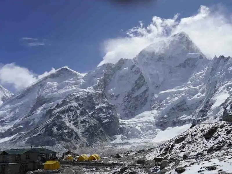
The Everest Base Camp trek is operating normally. The Khumbu drains into the Dudh Koshi, which has no connection to the Bhote Koshi corridor, and the standard approach is by air to Lukla rather than overland. Tribhuvan International Airport in Kathmandu has remained open throughout, handling both domestic and international flights. The thing to watch on an Everest itinerary in September is not the flood; it is the late-monsoon cloud at Lukla, which delays flights every September and always has.
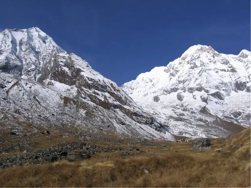
Annapurna region and Mardi Himal
The Annapurna Circuit, Annapurna Base Camp, Mardi Himal, and Ghorepani Poon Hill trails were not affected by the flood. The Annapurna region drains into the Marsyangdi and Kali Gandaki systems, well away from the flood corridor.
Getting there is the live issue. In its 1 September alert, the U.S. Embassy in Kathmandu reported that the Prithvi Highway, the main Kathmandu–Pokhara road was completely blocked at Krishnabhir in Dhading district, where erosion by the Trishuli River washed away a section of the road, and advised travellers not to assume through travel between Kathmandu and Pokhara or Chitwan was possible. If your itinerary includes a Kathmandu–Pokhara road transfer, ask your trekking operator about flying instead, and confirm on the day.
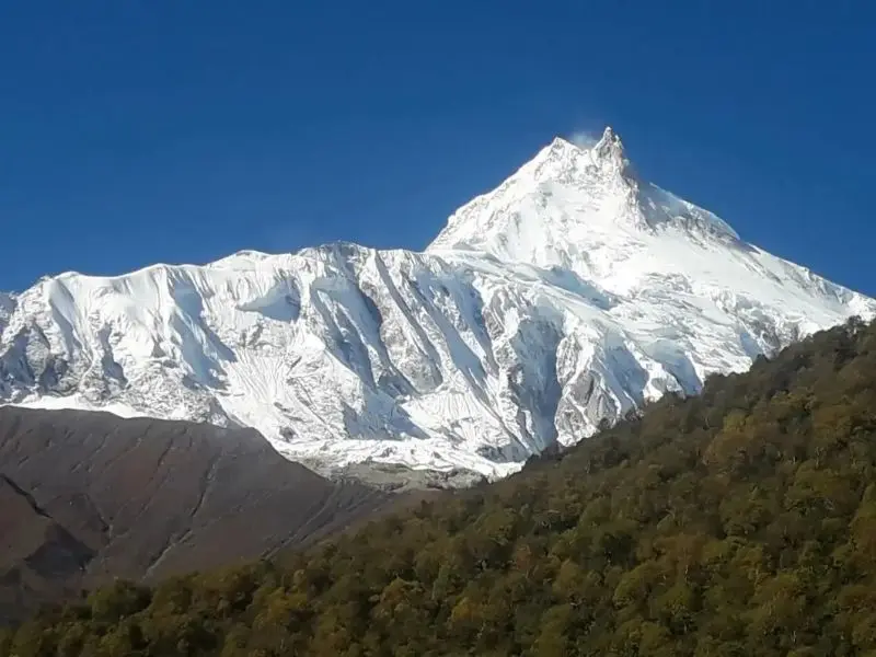
Manaslu region
The Manaslu Circuit is operating normally. It is reached via Arughat in the Gorkha district and follows the Budhi Gandaki, a different river system entirely. Manaslu is a restricted area, so you need the special permit and a licensed guide regardless of the flood; that requirement has not changed. Note that Gorkha district did take downstream damage along its river corridor, so road conditions on the approach are worth confirming even though the trek itself is unaffected.
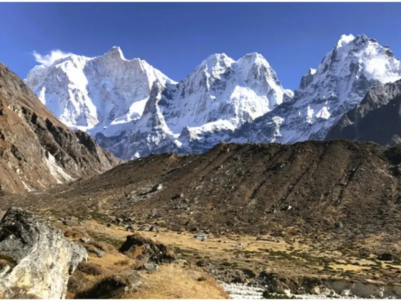
Kanchenjunga and Makalu
Both are operating normally, and neither is anywhere near the affected corridor. If you are looking for a region where the flood is simply not a factor in your planning, these two are it, with the usual caveat that both are remote, logistically demanding treks in their own right.
What Caused the 2026 Nepal Flash Flood?
The flood was not caused by monsoon rain. Nepal's Department of Hydrology and Meteorology recorded no significant rainfall in the 24 hours before the event, which ruled out an ordinary rain-driven flood almost immediately and sent scientists looking upstream instead.
The cause, as far as it is currently understood
According to disaster authorities and the International Centre for Integrated Mountain Development (ICIMOD), a large mass of ice and rock sheared off high near the Nepal–Tibet border and fell into the Lhende Khola, a tributary on the Tibetan side. The debris temporarily dammed the stream. That natural dam then breached, releasing a surge of water, ice, mud and boulders down the Bhote Koshi and into the Trishuli.
The speed is what made it so deadly. Jeffrey Kargel of the Planetary Science Institute, quoted by CNN, calculated that the flood wave covered its first 22 kilometers at an average of roughly 193 kilometers per hour. In a valley where riverside settlements sit meters from the water, that left almost no warning time.
The precise sequence has not been scientifically confirmed. Some early reporting pointed to a glacial lake outburst on the Tibetan side, other accounts to an ice avalanche, and Nepali authorities have launched a field assessment. ICIMOD scientists have also cautioned that while Himalayan glaciers are losing mass rapidly, it is too early to attribute this particular event to climate change.
Where the damage is concentrated
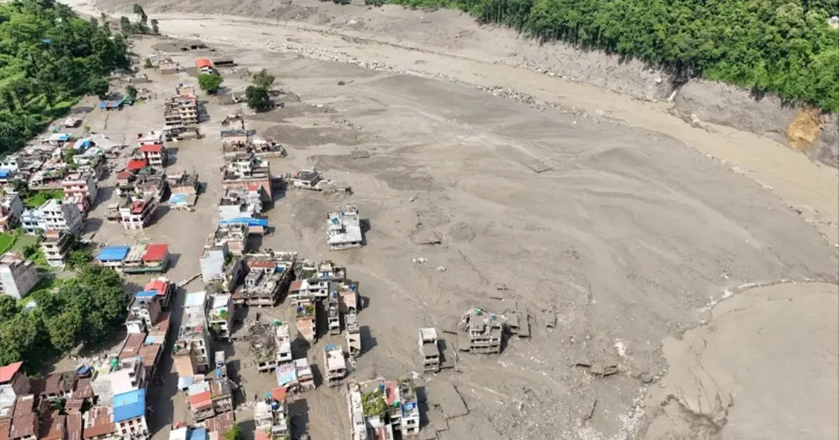
The water entered Nepal at Rasuwagadhi and Timure on the border, tore through Syabrubesi, then continued down through Betrawati and Trishuli Bazar into Nuwakot, Dhading, Gorkha, Chitwan, and the Nawalparasi districts.
Infrastructure losses are severe. Officials have confirmed that 32 bridges and close to 40 kilometres of road were swept away, including the entire road linking Betrawati in Nuwakot to the Rasuwagadhi border crossing. Fourteen hydropower and solar installations were affected. The Rasuwagadhi–Kerung crossing, the main overland link between Kathmandu and Tibet, was destroyed.
Langtang, Gosaikunda and the Tamang Heritage Trail: The Honest Picture
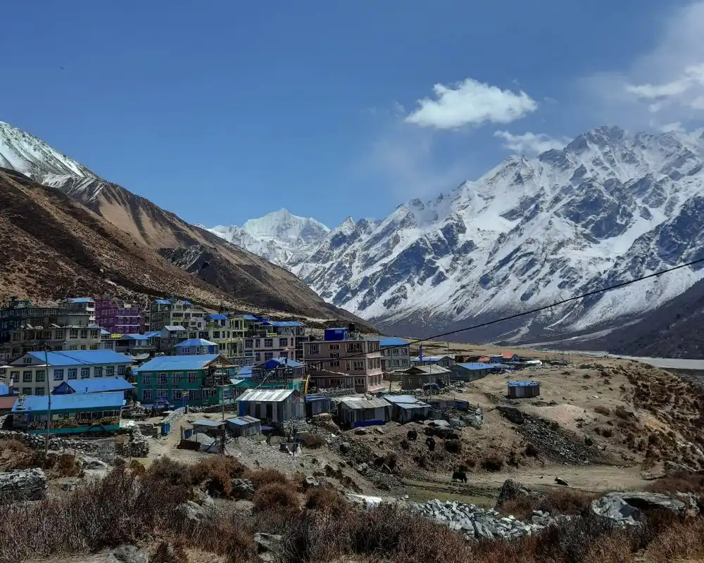
The Trail Was Not in the Flood’s Path. The Way in Was.
Here is the distinction almost every headline misses. The main Langtang Valley trekking trail follows the Langtang Khola, a different river from the Bhote Koshi that flooded. There is currently no confirmed report that the trail from Lama Hotel up through Ghoda Tabela, Langtang village, and on to Kyanjin Gompa was destroyed.
What was destroyed is the way in. Syabrubesi, the road-end town where the Langtang Valley trek and the Tamang Heritage Trail both start, took severe structural damage. The Pasang Lhamu Highway serving it was washed out across long sections, and the Trishuli–Mailung–Syabrubesi road was blocked entirely.
A trail that cannot be safely reached is closed in practice. That is the honest way to describe Langtang right now. It is not a ruined trail waiting to be written off; it is an intact trail behind a broken road, in a district where search and recovery operations still have priority over tourism logistics.
Can You Reach Langtang via Dhunche?
If you have been researching this, you have probably found flatly contradictory answers. Some trekking operators are presenting entry via Dhunche as a workable alternative that adds about a day to a standard itinerary. Others state that the Dhunche road is reserved for army, local authority, and rescue movement and is not approved for commercial or tourist transit. Both claims are currently published, and they cannot both be right.
The most recent official position is more careful than either. In its alerts of 30 August and 1 September, the U.S. Embassy in Kathmandu said limited small-vehicle access as far as Dhunche may be possible, but that reliable through access beyond Dhunche to Syabrubesi, Timure, the Langtang-area trailheads, and Rasuwagadhi has not been confirmed. Its instruction is unambiguous: do not travel north of Dhunche until authorities confirm reliable access and the flood threat subsides. The 1 September alert stated that the main road through Rasuwa toward those destinations remained closed.
There is also an active reason for caution beyond the road damage. Nepali and Chinese authorities are monitoring barrier lakes upstream near the border. One has been gradually draining, reducing the threat it poses; a second, larger one remains under assessment, and Nepali disaster authorities have said downstream flood risk will continue until both have fully drained.
The Sundarijal Walk-In, and Why It Is Not a Simple Substitute
A third option circulating online is the traditional walking route from Sundarijal on the Kathmandu Valley rim, via Chisapani and Kutumsang to Gosaikunda, and onward to Thulo Syabru and up into the Langtang valley. It is a real route, and it avoids the damaged road network entirely.
It is not, however, a like-for-like swap. It adds several days to the itinerary; it is a substantially harder trek and walked in early September, it means days of monsoon conditions on trails that are themselves subject to landslide risk in the monsoon. It also ends by entering the same district that official advisories currently tell travelers to stay out of.
What Should Women Do With a Langtang Booking With Women Adventures
Don't cancel on reflex, and don't rebook somewhere unfamiliar in a panic; those are the two most common expensive mistakes right now.
Talk to us instead via Phone Call, WhatsApp: +977 9841290101 / 9747508926 or mail: info@womanadventures.com. Depending on your dates, the sensible move is usually one of two things: hold the booking and decide closer to departure, or move the same dates to a region where nothing about your trip needs to change. Both are straightforward to arrange, and neither requires you to make a call today on information that will be different in a fortnight.
If You Are a Woman Trekking Alone, or Already in Nepal
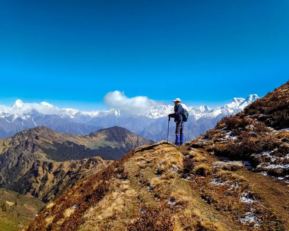
Outside the Rasuwa corridor, this Rasuwa flood has not affected most of the trekking destinations in Nepal where you can trek safely. What has affected is the Langtang region,for which, the rerouted itineraries and stretched lodge capacity introduce a different kind of risk than a normal season; one that has more to do with unvetted accommodation and improvised plans than with floodwater.
If You Are in Kathmandu or on a Trail Right Now
- Register with your embassy's traveller program. American citizens should enroll in STEP; other nationalities have equivalents. Embassies are using these systems to account for citizens near the affected area.
- Stay with your guide and group. Do not make independent route decisions based on a road segment someone told you had reopened; the embassy has specifically warned against relying on reports that say a single road segment is clear.
- Do not enter the disaster area to look for someone. Coordinate through Nepali authorities, the traveller's trekking company, and your embassy.
- Keep the basics to hand: Police 100, Ambulance 102, plus your embassy's emergency line and the Nepal Tourism Board tourist helpline.
If Your Itinerary Has Been Rerouted: What To Ask Before You Accept It
A rerouted trek can mean teahouses nobody on your operator's team has actually inspected, sleeping arrangements you did not agree to, longer days than you trained for, and lodges running at reduced capacity with more people in fewer rooms.
Before you accept a changed route, ask:
- Who from your team has walked this alternative in the last week? Not "we've used it "before"—this month.
- What are the overnight arrangements at each stop? Private room, shared room, or dormitory, named lodge by lodge.
- Will the group still have a female guide? Reassignments happen when itineraries shift, and this is the easiest thing to lose quietly.
- What is the turnaround plan if conditions change mid-route? Where does the group stop, who decides, and how do you get out.
- What has changed about the daily distances and altitude profile? A one-day addition can hide two very long days.
A good travel operator will answer all five without hesitation. Difficulty answering any of them is itself the answer.
Insurance, Evacuation and What Your Policy Probably Doesn’t Cover
Three things are worth checking with your insurer directly, because they are where women get caught out:
Cancellation versus disruption: These are different benefits. Many policies cover a trip that is curtailed or altered once you have travelled but will not refund a cancellation you choose to make in advance.
Advisory timing: A common exclusion is that cancellation is not covered if a relevant government advisory was already in force when you booked. Since advisories for Rasuwa are now published, a Langtang booking made this week sits in a different position from one made in June. Ask your insurer to confirm in writing which applies to you.
Helicopter evacuation: Check the altitude limits and the cover ceiling, and understand that in the affected districts helicopters are currently prioritized for emergency and relief work rather than commercial trekking flights. Cover on paper is not the same as an aircraft being available.
Alternatives to a Langtang Trek This Autumn
Langtang is short, moderate, and relatively affordable, which is exactly why it gets booked. "Do Everest Base Camp instead" is not a real answer for someone with ten days and a Langtang budget. Three alternatives that genuinely fit that brief:
Mardi Himal Trek: It is a moderate trek of roughly six to seven days with an outstanding final viewpoint, reached from Pokhara. Similar fitness demand, similar trip length, and comparable cost. The main difference is the flight or road transfer to Pokhara at each end.
Ghorepani Poon Hill or Annapurna Panorama Dhampus to Sarankot Trekking: These treks work if you want to keep your dates and your budget almost exactly. Shorter days, teahouses at every stage, and the most forgiving option if the group's fitness varies.
Everest Panorama Trek: This trek suits anyone who can extend by a few days and would rather see the Khumbu than substitute another mid-hill trek. It is a step up in cost because of the Lukla flights, but it is not the full Everest Base Camp commitment.
Should You Cancel, Postpone, or Go?
If your trek is outside the affected corridor — Everest, Annapurna, Mardi Himal, Manaslu, Kanchenjunga or Makalu, then proceed. Do the normal late-monsoon checks on flights and road transfers, and pay particular attention to any Prithvi Highway leg, but the flood itself is not a reason to change your plans.
If you have a Langtang-region trek this season, talk to your operator about moving your region or your dates rather than cancelling outright. Cancelling forfeits money that a change of route usually does not.
If you hold a 2027 Langtang booking, there is no reliable basis yet for either reassurance or alarm, and anyone telling you otherwise is guessing. Road reconstruction on this scale takes months. Trails in Nepal have historically reopened well before the roads serving them were fully rebuilt. And no trail-specific engineering assessment of the upper Langtang valley has been published. Decide closer to the date, once search operations have concluded and the corridor has been properly assessed.
Conclusion: Nepal Needs Responsible Travelers Now More Than Ever
For many families across Nepal, tourism is more than an industry. It is their everyday livelihood.
Guides, porters, teahouse owners, drivers, local restaurants, small hotels, craftspeople, and mountain communities all depend on travelers choosing Nepal. When a disaster affects one part of the country, cancellations across Nepal can create an even wider impact on people and local businesses.
If your planned destination is open and confirmed safe to visit, please don’t give up on Nepal.
By travelling responsibly, staying in local lodges, eating at family-run businesses, and hiring local guides, you can directly support Nepal’s recovery while helping communities continue their livelihoods.
Nepal needs your support this year—not by travelling into affected areas, but by visiting the places that are safe and ready to welcome you.
Your journey can help keep businesses running, protect local jobs, and support families as the country recovers.
Frequently Asked Questions
Is Nepal Safe To Trek After the 2026 Flash Flood?
Yes, for most regions. Everest, Annapurna, Mardi Himal, Manaslu, Kanchenjunga, and Makalu were not in the flood's path and are operating normally. The Langtang region, including Gosaikunda and the Tamang Heritage Trail, is not currently accessible, and official advisories tell travelers not to go north of Dhunche.
Is Kathmandu Safe To Visit Right Now?
Yes. The flood did not pass through the Kathmandu Valley. Tribhuvan International Airport has remained open throughout and is handling domestic and international flights normally. Overland travel out of the valley toward Pokhara, Chitwan, and Rasuwa is the part that is disrupted, not the city itself.
Is the Everest Base Camp Trek Affected by the Nepal Flash Flood?
No. The Everest region drains into the Dudh Koshi, which has no connection to the Bhote Koshi corridor that flooded, and it is reached by air rather than by road through the affected districts. Lukla flights and the Everest Base Camp trail are operating on their normal schedule.
Is the Annapurna Circuit Safe After the Rasuwa Flood?
The Annapurna trails are unaffected; the Annapurna region drains into the Marsyangdi and Kali Gandaki. The complication is road access: the Prithvi Highway between Kathmandu and Pokhara was reported blocked at Krishnabhir on 1 September. Confirm your transfer and consider flying to Pokhara instead.
Is the Manaslu Circuit Open After the Nepal Flash Flood?
Yes. Manaslu is reached via Arughat in the Gorkha district and follows the Budhi Gandaki, a separate river system. Trekking continues without flood-related disruption. The restricted-area permit and licensed-guide requirements apply as they always have.
Is the Langtang Valley Trek Cancelled?
Commercial trekking to Langtang is currently suspended. The trail itself follows the Langtang Khola and is not confirmed to have been damaged, but Syabrubesi and the road serving it were severely hit, and official advisories instruct travellers not to travel north of Dhunche. There is no confirmed tourist route into the Langtang region at present.
Can You Reach Langtang via Dhunche?
Not reliably, as of 2 September 2026. The U.S. Embassy has said limited small-vehicle access as far as Dhunche may be possible, but that reliable through access beyond Dhunche to the Langtang trailheads has not been confirmed, and advises against travelling north of Dhunche, Rasuwa. Some operators describe a Dhunche alternative as bookable; that claim is not currently supported by official advisories.
Is Gosaikunda Open After the Flood?
No. Gosaikunda is reached through Dhunche in the Rasuwa district, and commercial access is suspended along with the rest of the Langtang region. The Gosaikunda lakes themselves were not in the flood's path; the problem is the road and the district-wide advisory against travel.
Is Chitwan Safe After the Rasuwa Flood?
Chitwan was not near the flood's origin, but it lies downstream on the Narayani system; it was among the districts where riverside communities were told to evacuate, and it recorded a significant number of the recovered dead. Road access from Kathmandu is disrupted. Confirm your route and travel method with your travel operator.
What Caused the 2026 Nepal Flash Flood?
A large ice and rock collapse near the Nepal–Tibet border fell into the Lhende Khola, temporarily damming it. When that debris dam breached, it sent a surge of water and debris down the Bhote Koshi into the Trishuli. Nepal's Department of Hydrology and Meteorology confirmed there was no significant rainfall beforehand, ruling out a monsoon flood.
Is It Safe for a Woman To Trek in Nepal Alone Right Now?
Outside the Rasuwa corridor, the flood has not changed the answer. The new risk is rerouting: unvetted teahouses, changed sleeping arrangements, and improvised itineraries. If your route has been altered, confirm the overnight arrangements, the guide assignment, and the turnaround plan before you accept it.
Should I Cancel My Nepal Trek for Autumn 2026?
Not unless your itinerary routes through Rasuwa district, Syabrubesi, Langtang, or Gosaikunda. For every other region, no change is needed beyond normal late-monsoon checks on flights and road transfers. For a Langtang-region booking, ask about changing the region or dates rather than cancelling.